
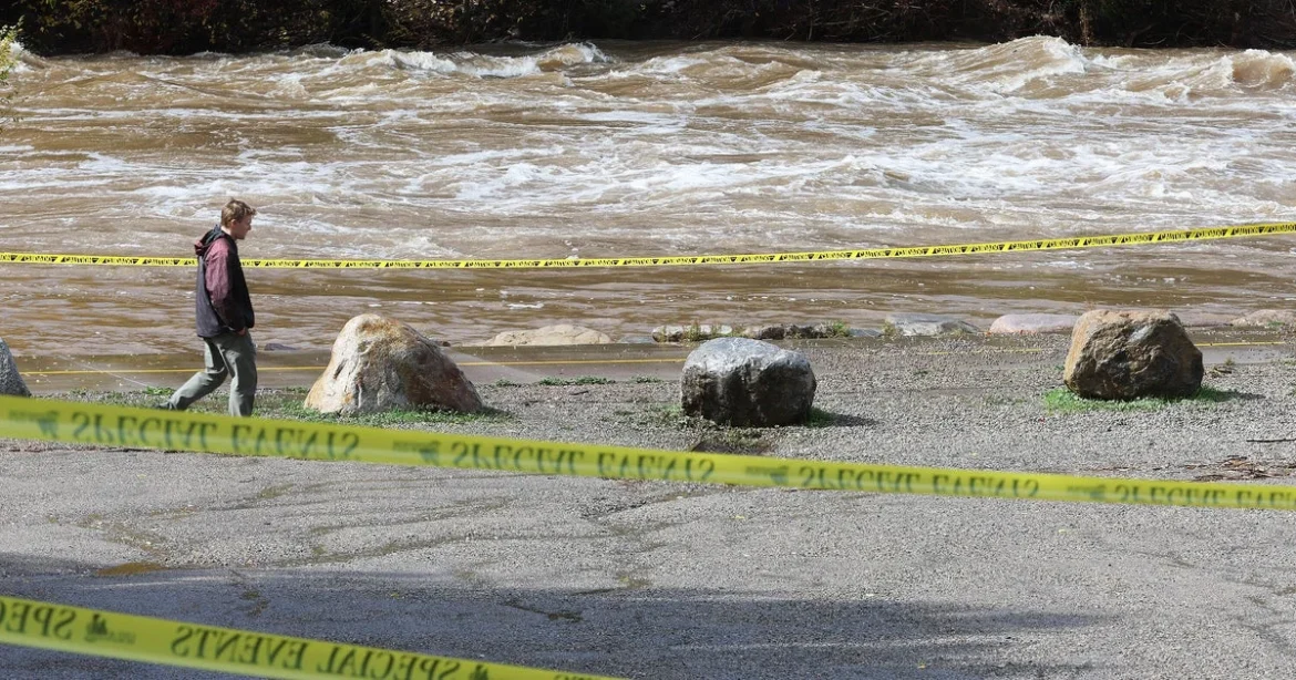
The Four Corners region, where the borders of Arizona, Colorado, New Mexico, and Utah converge, remains in a state of high alert as a persistent and volatile weather pattern continues to dump heavy precipitation across the Southwest. While local officials have observed a slight recession in water levels in some of the most severely impacted areas, the National Weather Service (NWS) has issued an urgent flood watch for the coming days. The ongoing threat is compounded by the saturation of the ground, which has reached maximum absorption capacity after several days of relentless storms that began mid-week.
The situation has triggered widespread evacuations and numerous water rescues, particularly in southwestern Colorado and northern New Mexico. Meteorologists warn that the cycle of torrential rain and thunderstorms is far from over, with the potential for flash flooding to devastate roads, small streams, and narrow canyons. Of particular concern are burn scars—areas previously stripped of vegetation by wildfires—where the lack of soil stability increases the risk of dangerous mudslides and debris flows.
A Chronology of the Escalating Crisis
The current weather event is the culmination of a sustained period of atmospheric instability that has affected the region for nearly two months. The moisture is being funneled into the interior Southwest from the Pacific Ocean, a phenomenon that has brought significant, albeit destructive, rainfall to areas that were, until recently, grappling with severe, long-term drought conditions.
- Mid-September 2026: Initial reports of moisture influx from the Pacific began to shift the regional climate, ending a prolonged dry spell but raising concerns about the soil’s inability to manage sudden, high-volume runoff.
- Wednesday, October 21, 2026: Rainfall intensity significantly increased across the Four Corners, marking the start of the current flooding cycle.
- Friday, October 23, 2026: Localized flooding in Pagosa Springs and San Juan County began to overwhelm local infrastructure.
- Saturday, October 24, 2026: The San Juan River experienced critical surges, forcing the closure of the San Juan River Bridge and necessitating emergency evacuations for residents near the riverbanks.
- Sunday, October 25, 2026: While some waters began to recede, the NWS extended flood watches as new storm cells developed, threatening to exacerbate existing damage.
Infrastructure Impact and Human Toll
The visual evidence of the flooding has been stark. Video footage circulating from Pagosa Springs, Colorado, depicts the complete inundation of residential structures, with some homes submerged to the point where only chimney tops remain visible above the churning brown water. The physical toll on infrastructure is equally severe.
Sheriff Shane Ferrari of San Juan County, New Mexico, who suffered significant flooding at his own residence, reported that while the situation in his immediate jurisdiction appeared to stabilize by Sunday, the recovery process is in its infancy. "I’m sorry, buddy. I tried. I really tried. But this one was bigger than the last one," said Pagosa Springs resident Chris Mott, whose testimony captures the despair of those who attempted to barricade their homes with sandbags, only to see them swept away by the sheer force of the currents.
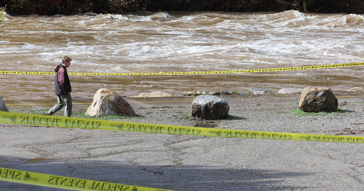
Official assessments from San Juan County spokesperson Devin Neeley suggest that while there have been no confirmed fatalities, the damage to private property is extensive. Beyond the structural loss, the flooding has introduced significant environmental and public health hazards. As floodwaters recede, they leave behind thick layers of mud and silt. Critically, reports indicate that this sediment is contaminated with raw sewage, a direct consequence of failures at local waste management facilities during the peak of the storm. These facilities were overwhelmed by the volume of water, leading to breaches that now pose a secondary health risk to residents returning to their properties.
The Broader Meteorological and Hydrological Context
CBS News meteorologist Andrew Kozak has projected that the current weather system is moving eastward, with the central and northern Plains expected to face the brunt of the storm by Sunday night. By early next week, the system is forecast to migrate toward the Upper Midwest, potentially repeating the cycle of heavy rainfall in regions already vulnerable to moisture.
The vulnerability of the Four Corners region is exacerbated by the "hydro-climatic paradox." After months of extreme drought, the ground in the high desert and mountain regions is often hydrophobic—meaning the soil becomes crusted and resists water absorption. When heavy rain falls on such terrain, it does not soak in; instead, it becomes rapid runoff, funneling into narrow canyons and stream beds with extreme velocity. This creates "flash" conditions where water levels can rise by several feet in a matter of minutes, leaving residents and motorists with little time to seek higher ground.
Recent months have seen a string of flood-related disasters across the American West. The Grand Canyon, in particular, has seen a series of deadly flash flood incidents that have prompted federal investigators to re-evaluate warning systems and public safety protocols for hikers and tourists. The current event in the Four Corners follows this trend, highlighting a regional inability to manage the sudden transition from severe drought to excessive precipitation.
Official Response and Recovery Challenges
The Colorado Department of Transportation (CDOT) remains on high alert, monitoring bridge integrity and road stability. The closure of the San Juan River Bridge serves as a primary logistical bottleneck, hindering emergency response and the transport of essential supplies to cut-off communities.
Devin Neeley, acting as the primary point of contact for San Juan County, described the current status as an "active disaster zone." He noted that the term "downswing" is not yet applicable to the recovery effort. The lack of electricity remains a major hurdle; utility crews have been unable to access many affected areas due to flooded roads and compromised infrastructure. Officials warn that for many residents, a return to normalcy—including the restoration of power and the mitigation of sewage contamination—will likely take days, if not weeks.
From a long-term perspective, urban planners and emergency management agencies are now facing questions regarding the adequacy of existing flood mitigation systems. Many of these systems were designed for a different climate reality. The frequency of these "once-in-a-generation" events suggests that the infrastructure of the Southwest may require a fundamental overhaul to survive the shifting patterns of Pacific moisture inflow.
Economic and Environmental Implications
The economic impact of the 2026 autumn floods will be felt for months. Beyond the immediate costs of emergency rescue and structural repairs, the agricultural sector in the Four Corners region faces the potential for soil erosion and the loss of crops. The contamination of land with sewage and debris will also require extensive environmental remediation to ensure that local water tables are not permanently compromised.
While the immediate focus remains on life safety and the stabilization of the San Juan River corridor, local governments are beginning to coordinate with state and federal agencies to prepare for the long-term recovery. This includes identifying funding for infrastructure resilience, such as bridge fortification and the modernization of waste management systems to prevent future breaches.
As the storms move eastward, the residents of the Four Corners are left to deal with the aftermath of a week that has redefined their local landscape. The combination of structural failure, environmental contamination, and the psychological toll of recurring natural disasters underscores the vulnerability of the region. As of Sunday evening, the focus remains on the forecast; every new storm cell is a reminder that the environment in the Southwest has become increasingly unpredictable, and the recovery process will be a long, arduous task for the affected communities.
