
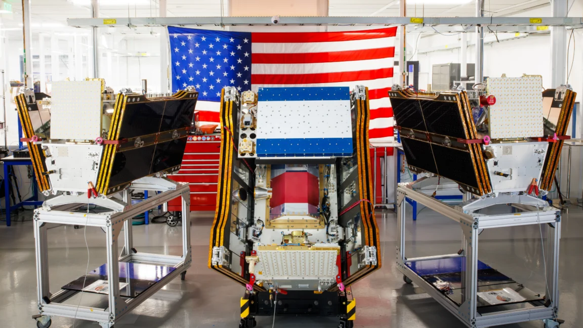
As vast plumes of smoke from an unprecedented number of wildfires choked skies across Canada and the United States in July 2026, a significant advancement in global wildfire detection became operational. The first three satellites of the Google-backed FireSat program have successfully been deployed into orbit, marking a pivotal moment in the fight against increasingly destructive wildfires. These advanced microsatellites are poised to revolutionize wildfire detection, offering the capability to identify even nascent blazes in critical regions including the United States, Australia, and Europe before the close of the year.
The successful launch of these three satellites aboard a SpaceX Falcon 9 rocket from Vandenberg Space Force Base in California on July 7, 2026, signifies the attainment of "initial operational capability" for the FireSat constellation. This ambitious project, managed by the nonprofit Earth Fire Alliance, represents a paradigm shift in how the world monitors and responds to the growing threat of wildfires. Following a rigorous three-month calibration and testing phase, the satellites are set to commence active data dissemination to fire management agencies worldwide. Their orbital path is designed to provide at least two daily observations of every fire-prone region on Earth, a critical improvement over existing surveillance capabilities.
FireSat is distinguished as the inaugural satellite constellation specifically engineered for the detection of wildfires. Its design prioritizes the identification of smaller fires that often elude current satellite observation methods. Developed by the California-based satellite manufacturer Muon Space, the FireSat program has secured substantial financial backing, including over $15 million from Google, to facilitate its initial deployment. Further bolstering this initiative, the Bezos Earth Fund has committed an additional $26 million, underscoring the global recognition of the urgent need for enhanced wildfire detection technology.
Technological Prowess: Peering Through Smoke and Clouds
Each FireSat satellite is equipped with sophisticated multispectral imaging technology. This advanced capability allows the satellites to effectively penetrate smoke and cloud cover, a persistent challenge for traditional remote sensing. Crucially, the system is designed to detect fires as small as five by five meters (approximately 16 by 16 feet). This remarkable sensitivity was rigorously tested and validated by a preceding FireSat Protoflight satellite, which was launched in March 2025. During its operational period, the Protoflight satellite captured over one million images, demonstrating a consistent ability to detect low-intensity blazes that remained invisible to conventional satellite systems. This technological leap promises to provide earlier warnings, enabling a more proactive and effective response to incipient wildfires.
A Phased Rollout and Expanding Global Coverage

The initial deployment of three satellites is the first phase of a much larger constellation. As more satellites are launched in subsequent phases, the FireSat program aims to achieve an unprecedented hourly revisit rate for imagery anywhere on Earth by 2029. The ultimate vision is to deploy a full constellation of over 50 satellites by the early 2030s, which would enable near real-time monitoring, with imagery potentially available every 20 minutes.
The "early adopter" program is already engaging with critical fire management agencies, including those in California and Colorado in the United States, as well as counterparts in Australia and Portugal. These organizations will be among the first to integrate FireSat data into their operational workflows, leveraging the enhanced detection capabilities for improved wildfire management and response strategies.
Projected Economic and Environmental Benefits
The potential impact of the FireSat program extends far beyond immediate fire suppression. The Earth Fire Alliance has projected that even an hourly revisit rate from the FireSat constellation could yield substantial benefits. These include saving over $1 billion in annual fire damage costs, preventing the release of approximately 22 million tons of carbon emissions, and crucially, protecting an estimated 3,500 homes and 1.3 million acres of land annually. These projections highlight the significant return on investment for such advanced wildfire monitoring technology, both in terms of economic savings and environmental preservation.
Google’s AI Integration and Climate Resilience
Google Research is poised to play a crucial role in maximizing the utility of FireSat data. The company plans to leverage its advanced AI models to analyze and compare operational FireSat imagery with historical data. This integration will enhance the accuracy of identifying very small fires and provide valuable insights for predictive wildfire modeling. Google has publicly hailed the launch as "another tangible step forward in putting practical AI to work for climate resilience," emphasizing its commitment to utilizing technology for environmental solutions.
The Growing Challenge of Wildfires and Climate Change

While the FireSat program represents a significant technological stride, it is deployed against a backdrop of a worsening global wildfire crisis, inextricably linked to climate change. The very advancements in AI that power wildfire detection, such as the development of sophisticated AI models, come with substantial energy demands. The proliferation of large AI data centers requires vast amounts of electricity, often sourced from new natural gas projects in the United States. Projections indicate that these data centers could collectively emit over 129 million tons of greenhouse gases annually, posing a complex challenge for climate goals. Google itself has acknowledged the difficulties in sourcing sufficient clean energy to offset the escalating energy consumption of its data centers, which saw a 37 percent increase in electricity usage in 2025 alone.
This juxtaposition highlights a critical tension: the use of advanced technology to combat climate change impacts while simultaneously contributing to the energy demands that exacerbate the problem. FireSat’s capabilities are undeniably vital, but they represent only one facet of a multifaceted wildfire crisis. Effective wildfire management necessitates robust funding for fire agencies, comprehensive ecosystem management strategies including prescribed burns, and the capacity for rapid and effective suppression of uncontrolled fires. These tasks have become increasingly challenging due to the intensifying effects of global warming.
The Canadian Wildfire Crisis: A Stark Reality
The urgency for advanced wildfire detection tools is underscored by the catastrophic wildfire events unfolding globally. The massive wildfires that have ravaged Canada’s boreal forests in recent years serve as a stark example. These fires have forced thousands of individuals from First Nations communities to evacuate, confronting them with fast-moving blazes and hazardous air quality. The resulting smoke clouds have blanketed vast areas of Canada and the United States, exposing over 100 million people to dangerous levels of air pollution.
Timeline of Key Events:
- March 2025: FireSat Protoflight satellite launched, successfully demonstrating advanced wildfire detection capabilities, including the ability to spot low-intensity blazes invisible to existing satellites.
- July 7, 2026: The first three operational FireSat satellites are launched aboard a SpaceX Falcon 9 rocket, marking the program’s transition to initial operational capability.
- Late 2026: The three operational satellites are slated to begin providing wildfire detection data to fire agencies in the United States, Australia, and Europe.
- 2029: FireSat program aims to achieve an hourly revisit rate for imagery globally.
- Early 2030s: Full constellation of over 50 satellites projected to be launched, enabling imagery availability every 20 minutes.
The Climate Change Connection
The increasing size and intensity of wildfires, particularly in regions like Canada’s boreal forests, are directly attributable to climate change. Human-induced greenhouse gas emissions are driving global warming, creating hotter and drier conditions conducive to more frequent and severe fire events. Canada has experienced some of its most destructive wildfire seasons in recent years, with 2023 and 2025 ranking among the top ten worst on record.

Scientists have long predicted these outcomes. Werner Kurz, a retired senior research scientist at Natural Resources Canada, stated in an interview with The Atlantic, "What is unfolding is what climate and forest scientists have been predicting for 30 years. That as the world gets hotter and drier, we are exposing forests to more and more risk, and the old strategies of fire suppression are simply being overwhelmed."
Resource Limitations in Fire Suppression
Combating wildfires in remote, often uninhabited forest regions demands specialized aerial resources, including fixed-wing air tankers and heavy-lift helicopters equipped to deploy fire retardants and transport firefighting crews. However, the financial burden of acquiring and maintaining these assets typically falls on individual Canadian provinces. In recent years, the demand for these aircraft has been so high that virtually all available resources have been deployed to combat ongoing fires. To address this critical shortfall, the Canadian government has taken steps, such as leasing 10 new aerial firefighting aircraft in May 2026, to augment nationwide response capacity as surge assets for provinces.
As of July 17, 2026, the Canadian Wildland Fire Information System reported nearly 900 active wildfires across the country, with over 3,600 fires having already burned more than 6.6 million acres. A significant number of these fires are classified as "out of control," and fire agencies are increasingly forced to make the difficult decision to merely monitor these blazes rather than actively suppress them. This strategic shift is driven by the necessity of managing limited resources and, critically, by the imperative to protect the lives of firefighters.
The FireSat Imagery: A Visual Example
Infrared imagery from the FireSat program offers a compelling visual representation of wildfire dynamics. An image captured on June 15, 2025, depicting the Nipigon 6 fire in Ontario, Canada, clearly delineates active fire regions at the top of the image. The middle section shows a transition from active flames to burn scars, while the bottom illustrates older burn scars. This detailed visualization, provided by Muon Space and the Earth Fire Alliance, highlights the program’s ability to map the progression and aftermath of fires with unprecedented clarity.
The FireSat program represents a crucial technological advancement in addressing the escalating global wildfire crisis. By providing earlier and more accurate detection capabilities, these satellites offer a vital tool for protecting lives, property, and the environment. However, their deployment also serves as a potent reminder of the broader climate challenges and the complex interplay between technological solutions and the energy demands that can contribute to the very problems they aim to solve. A holistic approach, integrating advanced detection with robust resource allocation and effective climate change mitigation strategies, will be essential to truly gain the upper hand against the growing threat of wildfires.
