
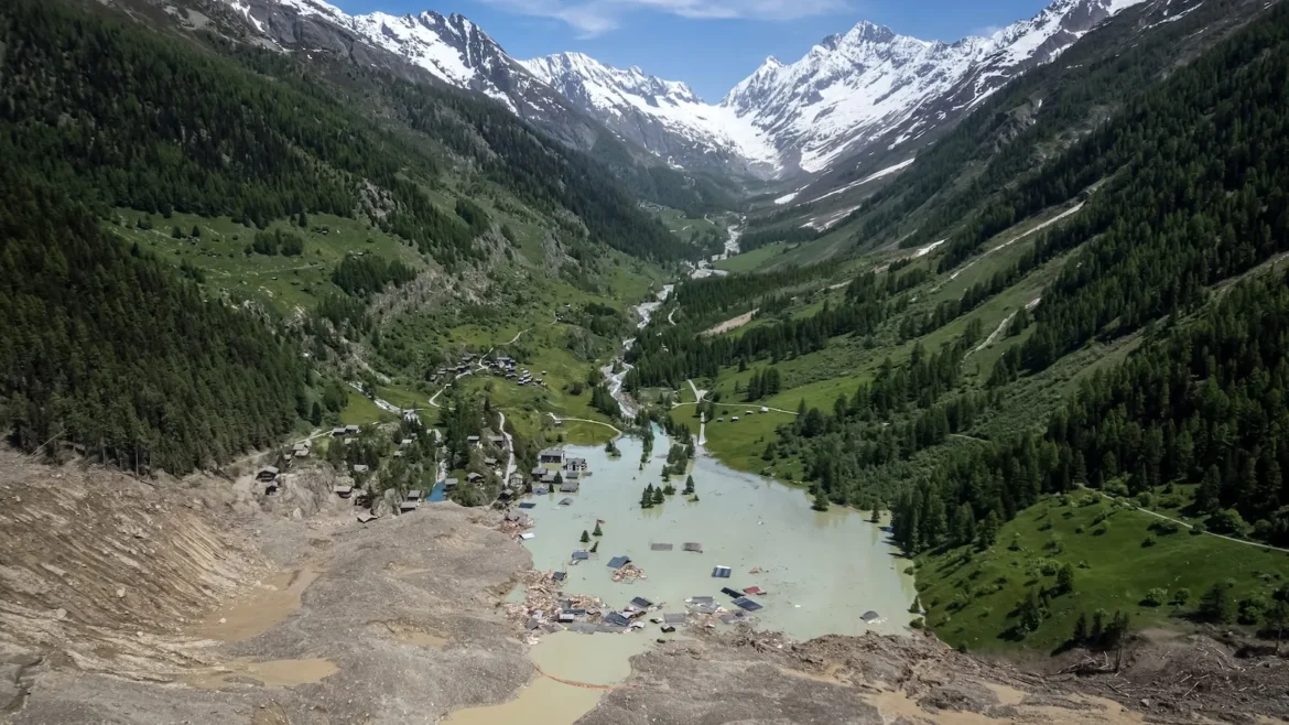
On August 26, a catastrophic slope failure near the border of Nepal and Tibet unleashed seven billion cubic feet of glacial ice and rock—a volume equivalent to the capacity of 100 football stadiums—into the valley below. The massive landslide plummeted roughly one mile in a near-vertical descent, striking the riverbed with such force that it generated a turbulent, high-velocity slurry of mud, water, and debris. This torrent, moving at speeds estimated at 100 miles per hour, surged through downstream valleys, obliterating remote villages and claiming more than 1,300 lives. With thousands still listed as missing, the event stands as one of the deadliest environmental disasters in the region’s modern history.
A Chronology of the Disaster
The event began with the structural failure of a mountainside, a phenomenon increasingly linked to the thermal degradation of permafrost and the loss of glacial support. As the massive volume of debris entered the river system, it created a hydraulic shockwave. By the time the surge reached populated areas downstream, the impact was instantaneous.
In the immediate aftermath, local emergency services and international aid organizations mobilized search-and-rescue operations. However, the sheer scale of the debris field and the remote, rugged terrain of the Himalayas have hampered recovery efforts. Reports indicate that communication infrastructure in the affected valleys was severely compromised by the initial wave, leaving many communities isolated for days. While search efforts continue, experts suggest the window for finding survivors in the dense, compacted mud has effectively closed.
The Science of Slope Instability
To understand why this disaster occurred, one must look at the mechanical relationship between ice and rock. Glaciers act as natural anchors for mountain slopes. Over centuries, these massive sheets of ice provide both mechanical buttressing and a thermal "glue" through permafrost—the layer of frozen soil that binds bedrock and scree together.
As global temperatures rise, this foundational support system is failing. The world’s glaciers have contracted by approximately 20 percent over the last century, and current climate projections suggest an additional 25 percent loss by 2100. Each fraction of a degree in global warming accelerates the thinning of these ice masses.
When a glacier retreats, it leaves behind unstable, newly exposed slopes. Furthermore, meltwater—now more abundant than at any point in the last millennium—seeps into existing fractures in the mountain’s bedrock. This process, known as "hydro-fracturing," widens these cracks over time, eventually reaching a tipping point where the structural integrity of the slope is lost. This is the same mechanism that led to a 1,500-foot-tall tsunami in Alaska’s Tracy Arm last year, underscoring that the risks associated with glacial retreat are global, not just regional.
The Challenge of Early Warning Systems
The disaster in Nepal has reignited the debate over whether modern technology can effectively mitigate the risks of glacial hazards. Experts argue that while early warning systems have seen success in other parts of the world, the geography of the Himalayas presents unique hurdles.
In Juneau, Alaska, the Suicide Basin presents a recurring flood threat, but it is one that researchers have managed to monitor with high precision. Hydrologist Eran Hood of the University of Alaska explains that the predictability of the basin—a singular, known location—allows for the installation of cameras, laser-based elevation sensors, and regular drone-mapping missions. "Every single cell phone in Juneau goes off when the lake starts to drain," Hood noted, emphasizing that constant, data-driven surveillance is the bedrock of their safety strategy.
Similar successes have been observed in the Andes, where Peru has spent decades draining high-risk glacial lakes to prevent dam bursts, a strategy that has undeniably saved tens of thousands of lives. In the Swiss Alps, authorities successfully evacuated the village of Blatten last year just days before a major landslide engulfed the area, proving that with enough monitoring and foresight, lives can be saved.
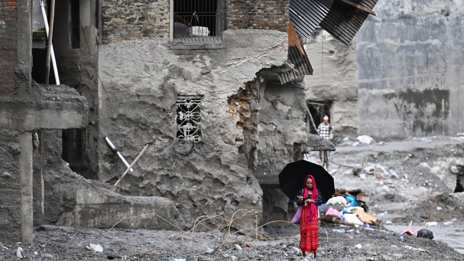
However, the Himalayas are vast, remote, and geologically volatile. "There is no regional system capable of continuously watching for the kind of sudden rock-and-ice collapse that triggered this," said Mark Carey, a professor of environmental studies at the University of Oregon. Covering thousands of glaciers spread across inaccessible, high-altitude terrain requires a level of resource investment that currently exceeds the capabilities of regional governments.
Leveraging Emerging Technologies
Despite the grim reality of the current situation, researchers are looking toward advanced sensing technologies to bridge the gap in early detection. One of the most promising avenues involves the repurposing of seismic networks.
The landslide in Nepal was so violent that it registered as a 5.2 magnitude earthquake on seismic sensors as far away as Alaska. Scientists are now exploring how to configure these networks to distinguish between tectonic activity and mass-movement events like landslides. Such a system could provide crucial minutes of lead time for downstream communities. The effectiveness of even a brief warning was demonstrated in this very tragedy: a school principal, alerted to the approaching torrent, was able to evacuate 900 students just before their building was swept away.
Another potential tool is the NISAR satellite, a joint mission between the United States and India. Designed specifically to detect minute shifts in the Earth’s surface, NISAR can see through dense cloud cover—a common feature of the Himalayan climate—to monitor glacial movement. Post-event analysis of NISAR data revealed that the mountain slope had indeed been showing signs of "slumping" or downward movement for several weeks before the final collapse. While this data was not integrated into a real-time public warning system, it serves as a proof-of-concept for the future of disaster prevention.
Additionally, fiber-optic sensing is being tested in Switzerland to detect "icequakes." By laying cables across glaciers, researchers can monitor the micro-fractures in the ice, which serve as precursors to larger structural failures.
The Broader Implications
The tragedy in Nepal is not an isolated event; it is a signal of a shifting environmental reality. As Dan McGrath, a glaciologist at Colorado State University, observes, the process of mountain stabilization is reaching a "binary" state. When a mountain is permanently frozen, it is stable; as it thaws, the transition period is fraught with instability.
The human cost of this transition is mounting. As glaciers continue to melt, the risk of "moraine-dammed" lake bursts and sudden slope failures will continue to rise. Policy makers are now faced with the difficult task of balancing the necessity of economic development in these regions with the escalating danger posed by a changing climate.
While research into monitoring technologies offers a glimmer of hope, experts emphasize that technology alone is not a "silver bullet." The scale of the Himalayan landscape, combined with the unpredictability of climate-driven geological events, means that many communities remain at risk. As the global community looks toward a future of climate adaptation, the events of August 26 serve as a stark, tragic reminder that the world’s "water towers"—the glaciers that provide water for billions—are undergoing a transformation that carries profound, often deadly, consequences.
The international scientific community is now calling for a more integrated, global approach to glacial monitoring, one that combines satellite remote sensing with localized sensor networks. Without such a commitment, the tragedy in the Himalayas may be viewed not as an anomaly, but as a precursor to future disasters in an increasingly unstable world.
